

Our Approach to Accuracy, Saves You Money
The business climate is uncertain and businesses, both private and public, are constantly striving to minimize the risks to which they are subjected.
Surtech can assist by providing accurate and timely information to many different industry sectors.
Surtech Time & Money Saving
Detailed topographic mapping and high-resolution aerial imagery are essential for proper geological exploration and operations management within the mining industry. Lidar data creates a highly accurate data set, which is very cost effective and much faster than traditional methods. Airborne Lidar surveys will collect millions of points per square kilometer. This point density creates a robust dataset to be used during volume calculations, geomorphology and structural geology analysis, transmission line and road planning, slope analysis and run off surface modeling for feasibility applications. Surtech will collect both imagery and Lidar data to deliver a seamless product. We can provide 3D models and high-resolution imagery for mapping of current operations as well as exploration areas, regardless of size.
Planning Strategy
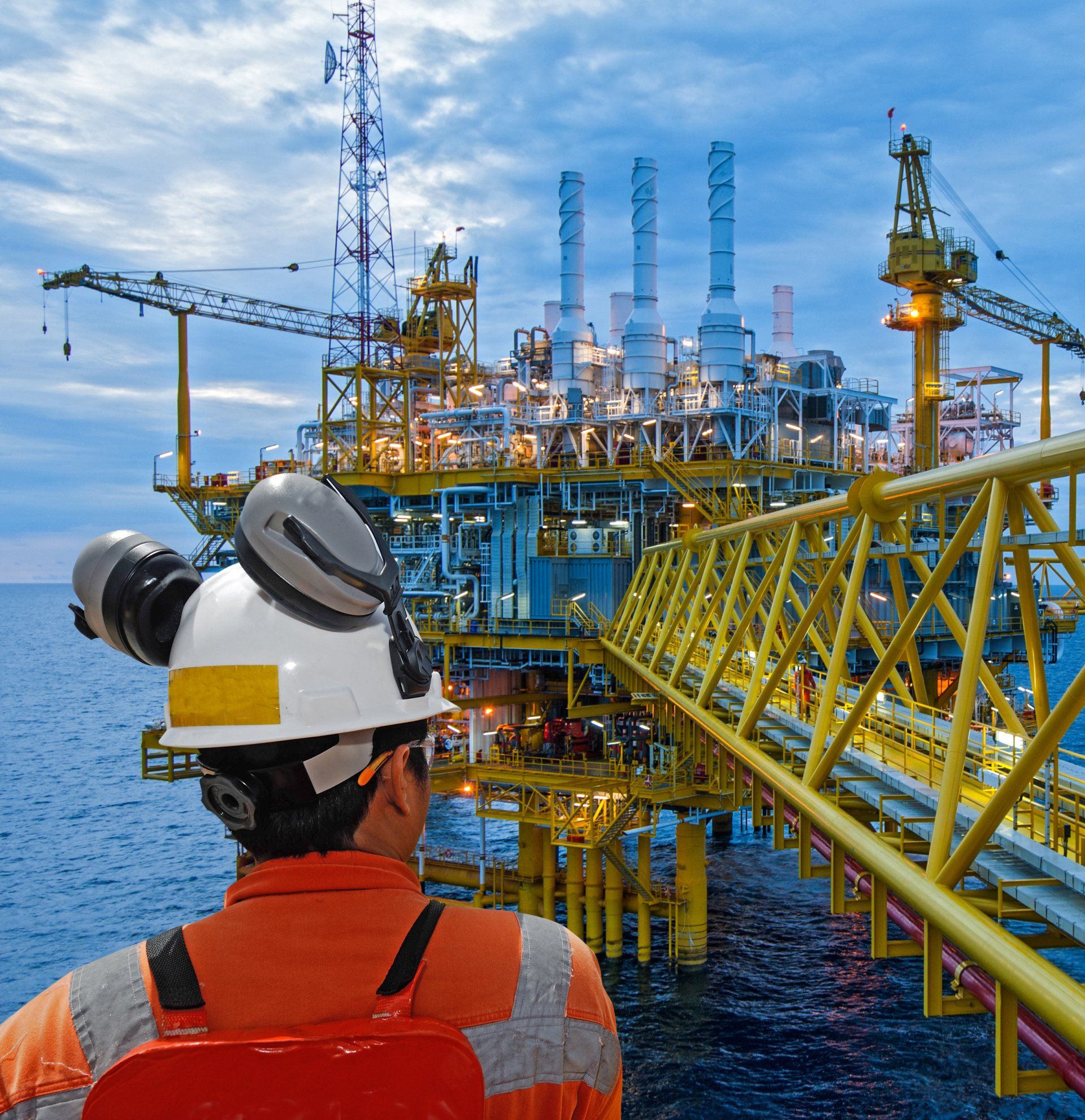
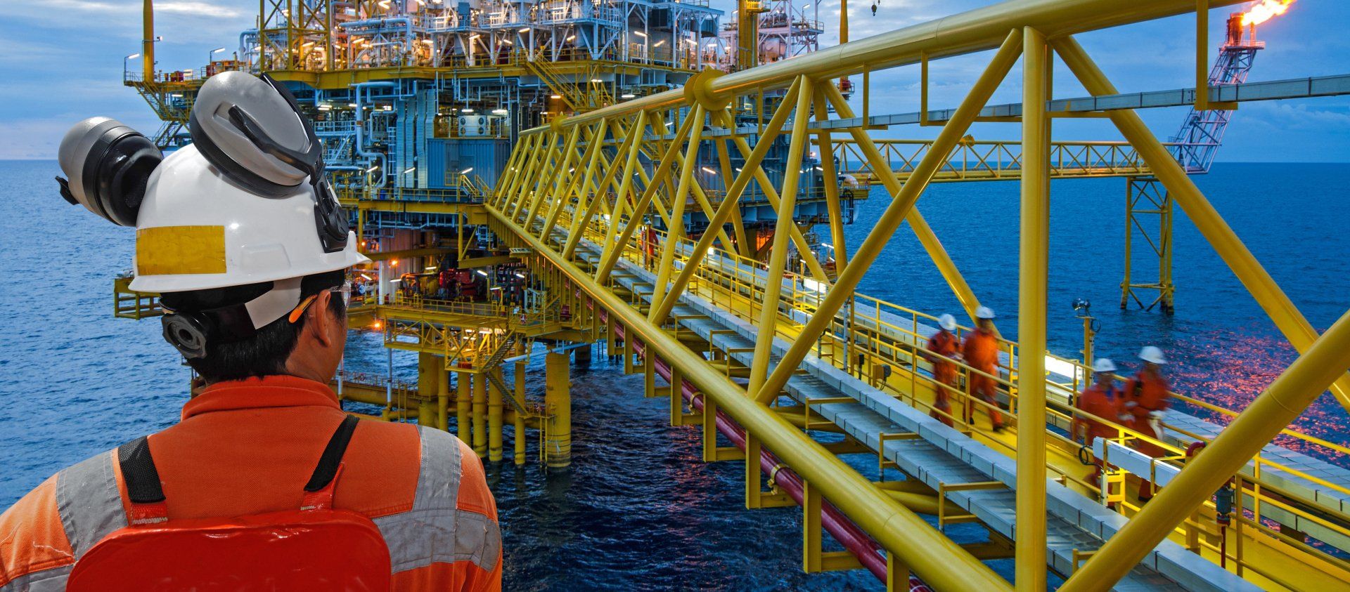
Surtech will provide accurate spatial data aiding in the planning and management of both exploration and development areas. The primary deliverables for our Oil and Gas clients are digital terrain models, slope and vegetation height maps, and elevation extractions for seismic applications.
The Accurate Choice
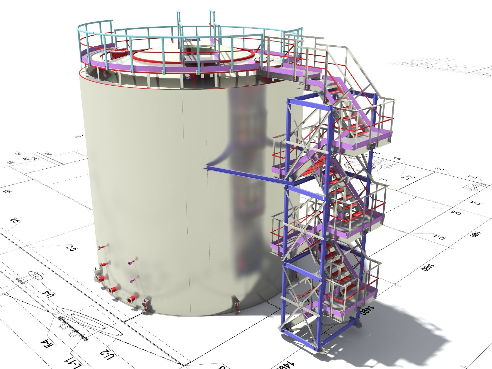
Lidar is a vital technology within engineering and construction projects by aiding the transition from 2D paper-based maps and sketches to 3D digital design. By producing a 3D model of a scanned area, in urban planning, for example, projects can be planned, simulated, and tested virtually using point cloud registration software and Lidar data. Lidar also improves with collaboration between engineers, project managers, and architects
For engineering applications such as transportation, land development, and commercial or industrial facility designs, it is the accuracy, density, and speed of Lidar data acquisition that makes it the preferred approach.
Critical Data When You Need It
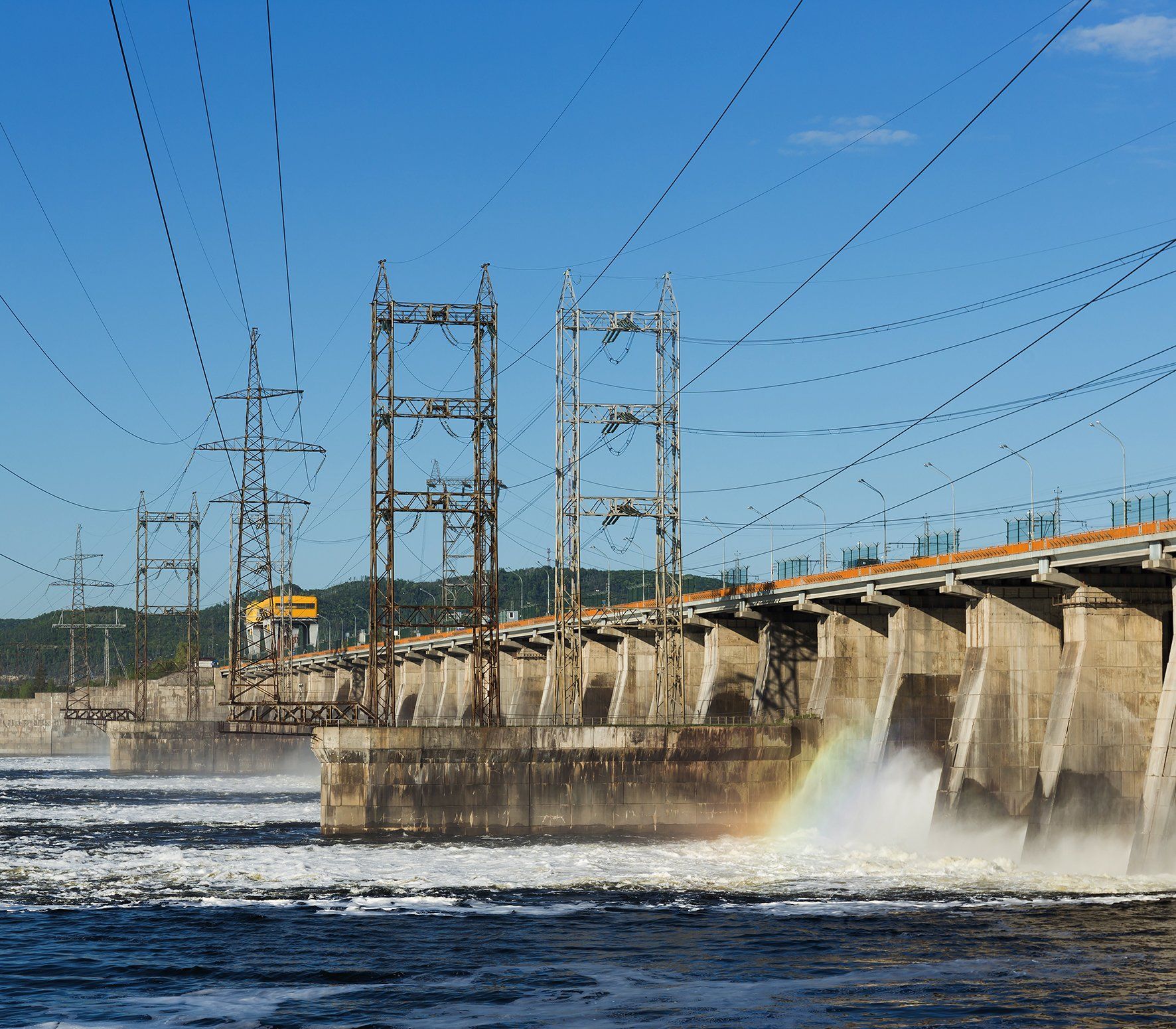
Much like the benefits of Lidar data for engineering applications, dense and accurate terrain data is critical for applications within the power industry as well.
Surtech has flown and collected Lidar data for hydro-electric sites, geothermal areas, and wind energy farms. These power solutions have utilized the digital terrain models from Lidar acquisition, combined with airborne imagery, to model route locations, plant sites, and water flow modelling.

Essential Accuracy Counts
Lidar technology can capture ground data to create Digital Terrain Models (DTM’s) as well as the top of the vegetation canopy to create Digital Surface Models (DSM’s). Surtech’s Lidar system an additionally capture multiple returns per pulse creating a vertical profile of vegetated areas. This is especially useful for forestry and agricultural applications such as tree counting analysis, predicting forest metrics, biomass calculations, identify variations, and improve change detection.
Advanced Disaster Mitigation
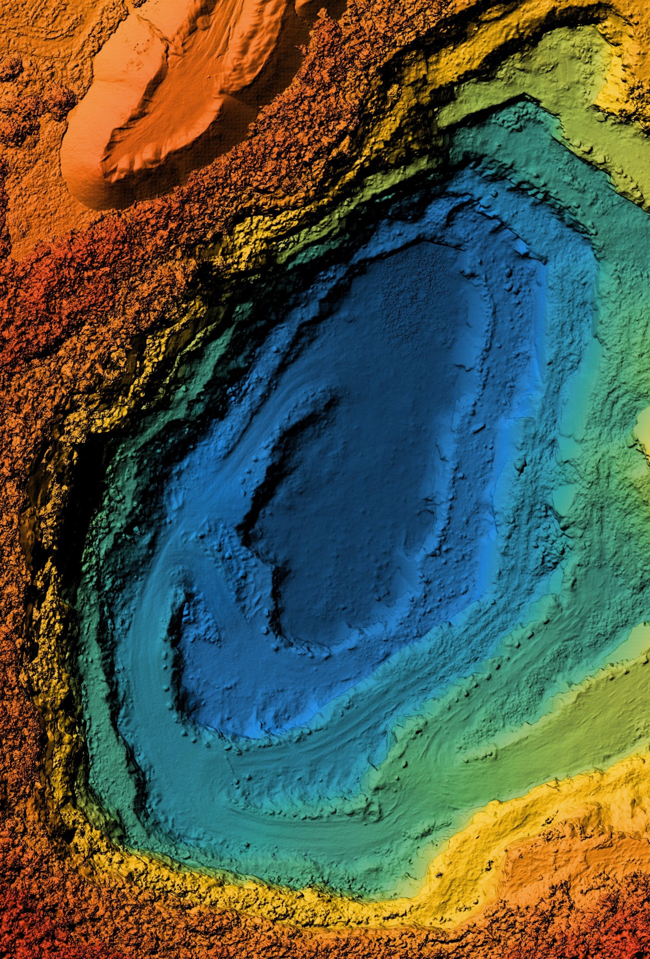
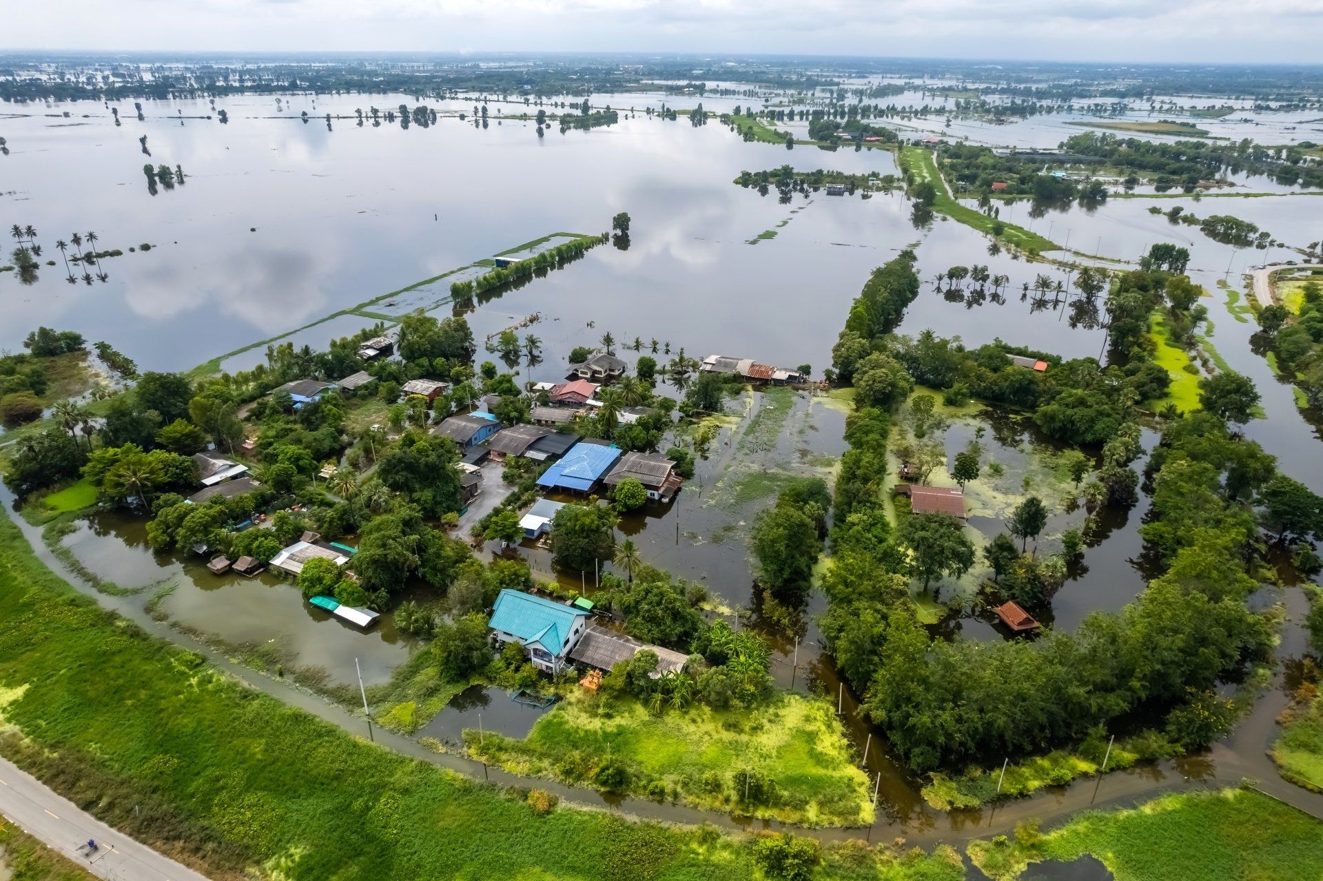
Lidar is frequently used for environmental impact studies. Digital elevation models acquired from Lidar data can be used for calculating slope, then modeled within a GIS to determine the affects, risk, and contingency in the event of a disaster. Flood mapping has long been the number one use of Lidar throughout the world. Lidar has the ability to capture large flooded areas, at very high density, within a short period of time.
Our Approach to Accuracy, Saves You Money
The business climate is uncertain and businesses, both private and public, are constantly striving to minimize the risks to which they are subjected.
Surtech can assist by providing accurate and timely information to many different industry sectors.
Surtech Time & Money Saving
Detailed topographic mapping and high-resolution aerial imagery are essential for proper geological exploration and operations management within the mining industry. Lidar data creates a highly accurate data set, which is very cost effective and much faster than traditional methods. Airborne Lidar surveys will collect millions of points per square kilometer. This point density creates a robust dataset to be used during volume calculations, geomorphology and structural geology analysis, transmission line and road planning, slope analysis and run off surface modeling for feasibility applications. Surtech will collect both imagery and Lidar data to deliver a seamless product. We can provide 3D models and high-resolution imagery for mapping of current operations as well as exploration areas, regardless of size.
Planning Strategy
Surtech will provide accurate spatial data aiding in the planning and management of both exploration and development areas. The primary deliverables for our Oil and Gas clients are digital terrain models, slope and vegetation height maps, and elevation extractions for seismic applications.
The Accurate Choice
Lidar is a vital technology within engineering and construction projects by aiding the transition from 2D paper-based maps and sketches to 3D digital design. By producing a 3D model of a scanned area, in urban planning, for example, projects can be planned, simulated, and tested virtually using point cloud registration software and Lidar data. Lidar also improves with collaboration between engineers, project managers, and architects
For engineering applications such as transportation, land development, and commercial or industrial facility designs, it is the accuracy, density, and speed of Lidar data acquisition that makes it the preferred approach.
Critical Data When You Need It
Much like the benefits of Lidar data for engineering applications, dense and accurate terrain data is critical for applications within the power industry as well.
Surtech has flown and collected Lidar data for hydro-electric sites, geothermal areas, and wind energy farms. These power solutions have utilized the digital terrain models from Lidar acquisition, combined with airborne imagery, to model route locations, plant sites, and water flow modelling.
Essential Accuracy Counts
Lidar technology can capture ground data to create Digital Terrain Models (DTM’s) as well as the top of the vegetation canopy to create Digital Surface Models (DSM’s). Surtech’s Lidar system an additionally capture multiple returns per pulse creating a vertical profile of vegetated areas. This is especially useful for forestry and agricultural applications such as tree counting analysis, predicting forest metrics, biomass calculations, identify variations, and improve change detection.
Advanced Disaster Mitigation
Lidar is frequently used for environmental impact studies. Digital elevation models acquired from Lidar data can be used for calculating slope, then modeled within a GIS to determine the affects, risk, and contingency in the event of a disaster. Flood mapping has long been the number one use of Lidar throughout the world. Lidar has the ability to capture large flooded areas, at very high density, within a short period of time.

Surtech offers a comprehensive range of specialised terrestrial and airborne surveying services utilizing professional personnel and leading edge technology.
GET IN TOUCH
Surtech offers a comprehensive range of specialised terrestrial and airborne surveying services utilizing professional personnel
and leading edge technology.
GET IN TOUCH
Surtech offers a comprehensive range of specialised terrestrial and airborne surveying services utilizing professional personnel
and leading edge technology.